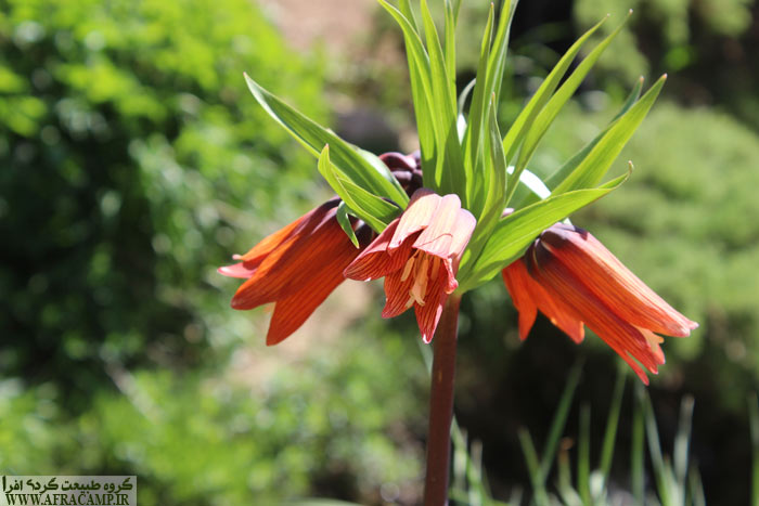
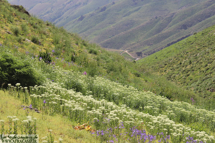
Qalat Shah mountain, natural habitat of overturned tulips(Mahabad, West Azerbaijan Province)
When it comes to travel, sometimes a photo or a post is so fascinating that nothing satisfies you except to see and experience that image.. This has been repeated to me many times, and one of these was the photos of overturned tulips on the slopes of Qalat Shah Mountain on a foggy and humid spring day.
It was then that in mid-June 1999, trying to achieve my dream, I embarked on this journey with my wife and children and a group of close friends..

For a quicker acquaintance with the area and the way to reach this attraction in a nutshell, you can read the last points of the article..
It was almost impossible to see the scenes in my mind. Because the weather was hot and only the cold of spring 99 could be a chance to see the overturned tulip in the mountains of Qalat Shah. The vacation we had was short and the distance from Tehran to Mahabad was long. We were supposed to be Qalat Shah one day and another night خورنج And other nights to Piranshahr and Sardasht and the end of the intensive trip to the south of West Azerbaijan. In the evening we left Tehran and were in Soltanieh around sunset. The weather in mid-June after last night's rain was like a refrigerator and attractive. We spent the night in a tent in Basij Soltanieh Park, which had a pavilion, and left for Mahabad at around 7 in the morning.. After various stops in the middle of the road, we were finally at the side of Qalat Shah on the Mahabad-Sardasht road at 4 pm.
To Qalat Shah
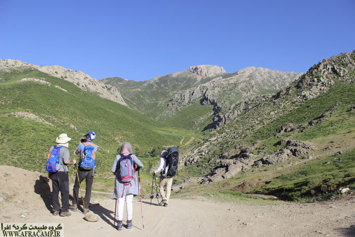
Now it was 35 km from this side road to Qalat Sinan village and about an hour. Because we were going to Qalat Shah tomorrow morning, there was no hurry and we stood by the river in the middle of the road and drank Saleh's espresso coffee.. We all hit the water and Sahand played well. The road was asphalt before Sheikhan and then dirt. The route information on the Internet was so vague and weak that we did not know how far to go? How far can you go by car? Where is the camp suitable?
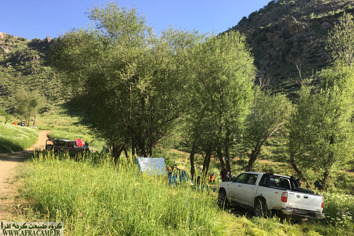
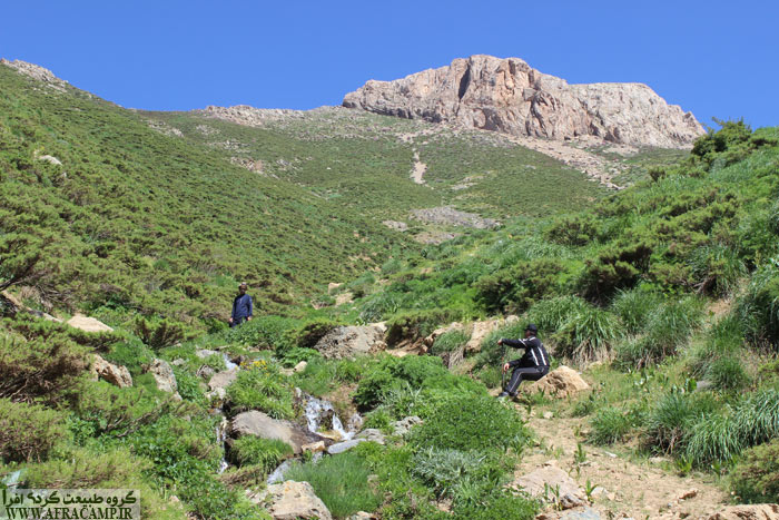
Anyway, we were on a dirt road and after a while the road became poor quality but passable. We were about after the village of Qalat Sinan. We did not take any risks and because it was close to sunset, we parked where we had a chance by the narrow road and found a suitable place to spend the night..
A night in the foothills of Qalat Shah
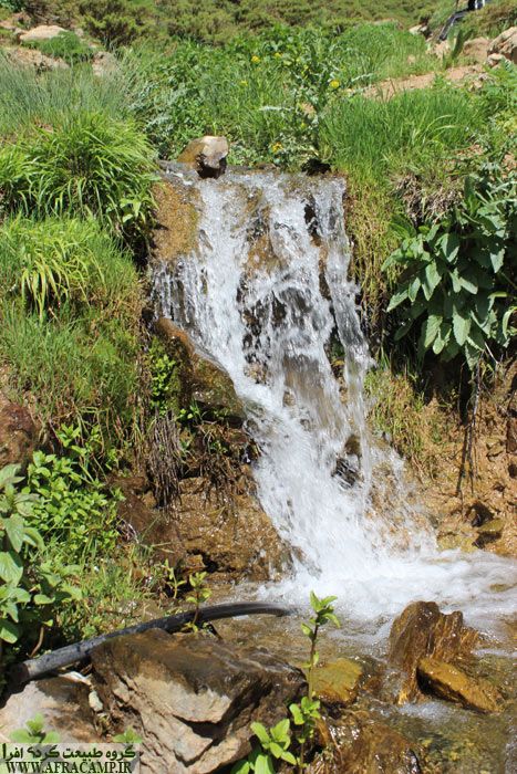
We were setting up tents when Mr. Ahmadi from Qalat was returning from the garden. Hello and have fun and short chat. He brought us some garden firewood. Mr. Ahmadi pointed to a spot near us and showed us the location of the spring, which was very helpful. This noble man insisted that we go to his house. The people of this region should be kept in mind. What a kind and honorable man he was. I had the Qalat Shah GPS file and did not ask Mr. Ahmadi about tomorrow's route. I just asked in frustration, is the tulip overturned? He said it probably is. I became very happy.
The starry night of Qalat Shah was very pleasant in warm weather and warmer than the night of Soltanieh.
At 6 o'clock in the morning, a charming voice woke us up. That valley was all over the garden. And later, through our ornithological friends, we recognized the sound we had recorded. Peri was Shahrokh. It was really weird and special.
To meet the overturned tulips
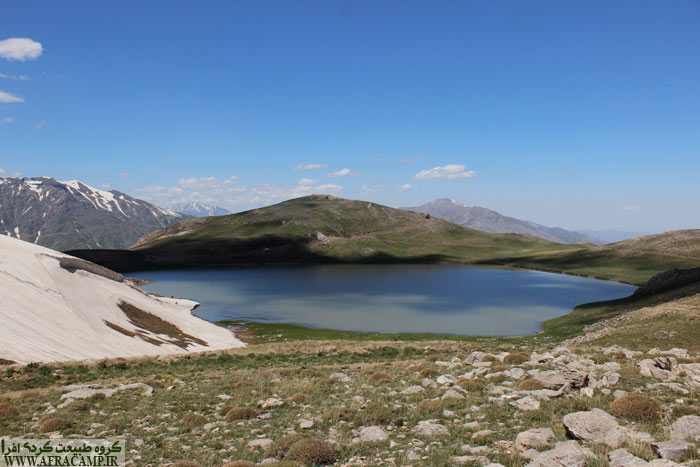
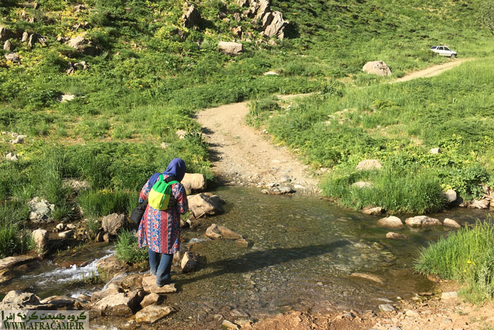
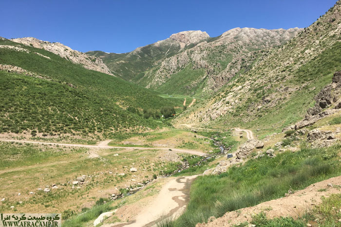
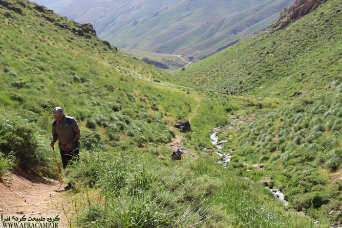
At 7 o'clock we gathered the camp and put the equipment in the trunk of the car. We were ready to move. By estimating the route from the GPS file, I knew that we are about 6 km away from the natural habitat of Laleh Vazhgon. We did not know what the dirt road was like. So we said we would walk. Walking on a dirt road was not pleasant, especially since a normal car could travel almost as far.. We were lucky that Ali Agha was on a high road with his tractor and he picked us up. Three in the front and two in the trailer. The tractor ride helped a lot because the weather was hot and the walk on the dirt road was not worth it. Let it be that in the return of two hours we returned all this way at the height of the sun. Ali Agha implemented almost the highest part of our route. From there we had a half hour walk to lower the altitude and crossed the dehydrated river and actually reached a point where it was better or the trek should start from there. It was a good place to camp at the foot of Qalat Shah and Rud, where dozens of people, mostly by two-wheeler, spent the night.. We had breakfast in the shade of the trees there and started Pakub. It was about 1.5 km from the convenient point of the camp where we ate breakfast to the first part of the overturned tulip habitat and entered the slope.. A beautiful stream was coming down and they were the stems of flowers and the flower itself had fallen. I did not despair and took the stream and went up. 15 minutes later, when I went, a few goals appeared and it was as if I had achieved my dream. The higher I went, the more flowers there were. We did not intend the peak. Sahand was asleep and Mahsa had stopped lower and was watching over him. I didn't want anything anymore. I returned with great enthusiasm to touch this area another day in the spring. In my opinion, tulip flowers should be scattered near the top of Qalat Shah.


Travel tips to Qalat Shah
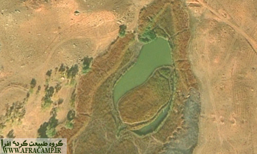
- The best way to reach Qalat Shah mountain is from Mahabad to Sardasht. Approximately 10 km after leaving Mahabad(A road next to Mahabad Dam), On the right side of the road is a side road that crosses a bridge over the river. You have to wrap up here. The side road is 18 km of asphalt up to an altitude of 1500 meters and then 11 km of dirt road for normal riding.. The villages of Sheikhan, Qalat Sinan are in the dirt part of the route. From the end of the road to the beginning of the natural habitat is 1.5 km of light mountaineering, which will have an altitude change of about 400 meters..
- If you are worried about a dirt road, you can go to Qalat village and coordinate with Mr. Khaled Ahmadi 09148706790 to go to the area.. They have a grocery store and a two-wheeler. You may also be able to talk to them about staying in Qalat and food. He will take you as far as you have to start mountaineering.
- The camp is conveniently located along the route and the best point is at the end of the road. There is also a spring near this place and the river water is suitable for cooking and tea.
- Know that this flower is one of the most unique in Zagros. Know that this flower is in danger of extinction. Do you know why? They destroy it out of selfishness. They pull the onion out of the ground to plant in their yard!!!! Know that the habitat of these special flowers has no human protection and you are the tourists who protect it and the natives of Qalat Shah are the permanent protectors.
I wrote these addresses and put the route file so that all those interested know where this beautiful area is so that everyone can try to preserve it and there is a demand to preserve this natural heritage..
To be familiar with the GPS file Donate Placed.

Every time I travel to the point of Iran, the magnitude and diversity of this land is ... Mdhvshm's not all ...