From Siahroud Lake to Lazour village(Arjmand, Tehran Province)
High trails, along with cool water, have all the features that a summer nature trip needs.. The route of a gorge called Tang Lask or Mishineh Death or Lazour between our village of Lazour and Siahroud Dam was the goal of our trip, which took place in mid-August..
Our decision was to cross a strait route from Siahroud Dam to Lazour village. For this reason, we rented from the village to the Nissan Siahroud Dam, which due to our small number, we accepted a high cost, and of course there was no choice because we wanted to implement the program..
Mr. Esfandiar, the driver of the van, the owner of a grocery store facing the Lazur bakery, arrived on time by contacting us.. The 15 km dirt route to Siahroud Dam takes about an hour. Along the way, due to the vacation of a few days, many cars were seen, all of which were going to Siahroud. The route initially had steep slopes, and if it was not raining, almost any car could cross it. When we reached the Black River Dam, it was full of cars and the sound of abnormal music from a minority created an unfavorable atmosphere..


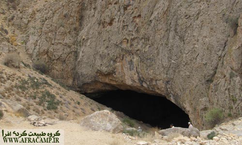
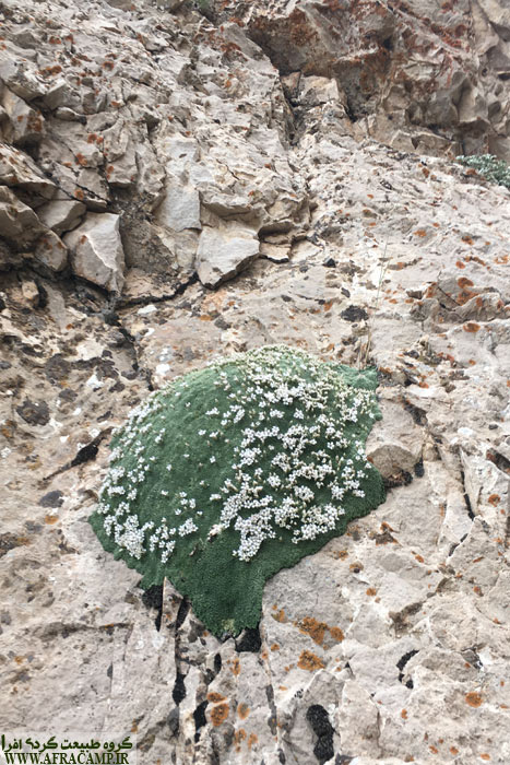
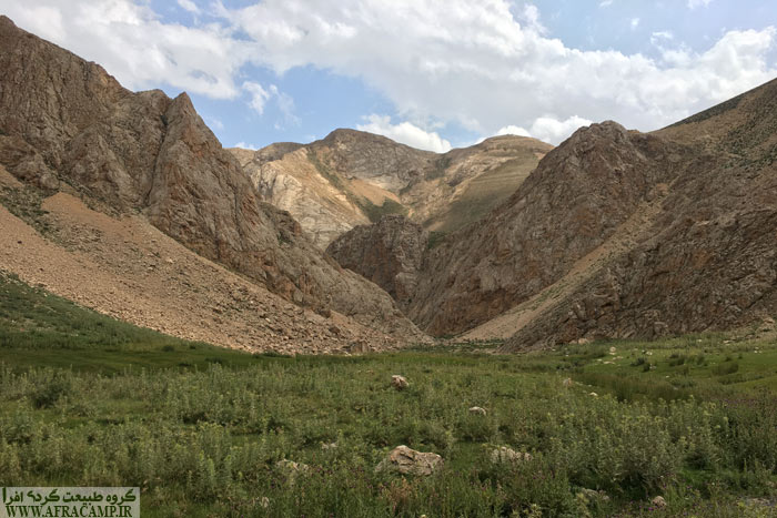
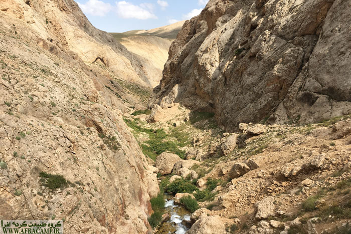
We ate lunch and after stopping for an hour around 3 pm, we headed to Tang Lask.. Siah Rud Dam Lake is small and its circumference is about 500 meters and it is at an altitude of 3000 meters. The wall of the concrete dam is about 2 meters. We went down the wall and after a few steps and down the wall, which is almost simple, we entered the gorge.. Inside the narrow hall, beautiful golden tongue plants were welcomed and I did not want to leave there at all.. We also made some mint to make mint tea when we reached the miraculous spring. 7 minutes later, we were in a miraculous pain. First we reached two small springs and then we reached a large miraculous spring that is surrounded by rocks.. The interesting atmosphere here made us stop for another hour and intoxicated us with tea and mint.. The movement of black clouds towards the summit of Mishineh Death and the forecast of evening rain was the only factor accelerating our movement.. The path is in the direction of the water path, which is now a river of miraculous spring water.
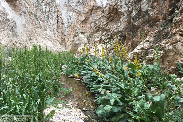
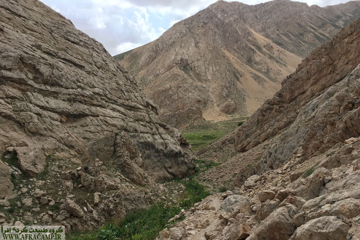

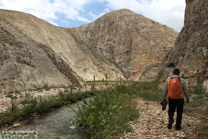
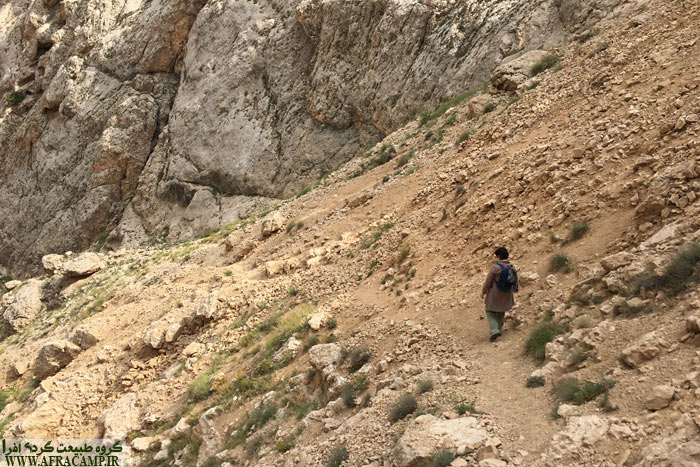
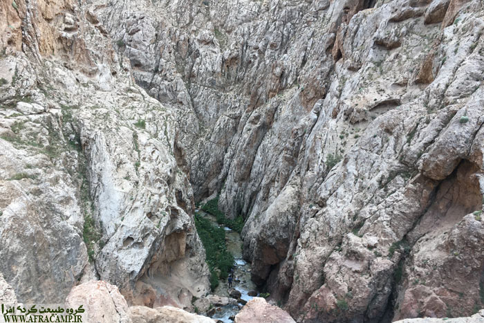
Along the way, Pakoob Kasir is clear in most places, but in some parts, you have to find your way over large rocks or through steep rocky slopes by the water, and it was a bit risky for me to carry Sahand in a backpack carrying a child.. But I passed with the help of batons and accuracy. The length of the narrow path is so beautiful and varied that it is not boring at all. First, it is Siahrood Lake, then the plain and the miracle of the spring, and then the strait and the river, and like a waterfall, and in some places it is completely narrow, like the Vashi strait, you have to cross the water, and at the end, the Lazur Gardens.. Along the way, you had to pass through the water many times, and on that cloudy day, the weather was cool, and passing through the cold water in August was shivering.. I walked in a light sneaker with good balance and friction and crossed the river with it.. But good sandals like neeko and Teva sandals are also good options. but if. Wearing mountain shoes, you will have difficulty crossing the water and you will have to overcome them. A part of the route is about 3 meters narrow and completely dry and there is no land route. The height of the water inside the gorge is almost below the knee.


After passing the challenging parts of the route, at the last khan of the route, we had tea and second mint and had fun with two boys who had started camping from Lazur for a few days.. We explained the route to the dam and asked them to continue the route to Lazur. The other clouds were ready to rain, and when they reached the narrow road and reached the dirt road, they exploded and rained against the sky.. We did not know the garden path and we came to the dirt road which was a good path in the rain until Lazur. The head of civilization was found and it was far from a special narrow space. It was evening when I found myself in the middle of nowhere.
Tips At Item This Navigation:
It takes about 4 hours to navigate the route. This path is not smooth and you have to cross large rocks and rivers along the way. Of course, it is not difficult to navigate, but you must be mentally prepared.
The difference in height between Lazur and Siah Rud is 620 meters. And the length of the route is 8.5 km. The source of drinking water between the route is only a miraculous spring near Siah Siahrud, but the whole route is along the river..
If you want to do one-way navigation and cross the Lazur-Siahroud dirt road by van, you can coordinate with Mr. Esfandiar ٣٣٠٩١٢٠٢٣٣٣٣.
Due to the altitude of the area and the coolness of the water, summer is recommended for navigating this route.
They are suitable for camping in Siahrood Lake and Miracle Plain, and along the road to Lazour, the entrance park of Arjmand city, there is a suitable pavilion space for camping..
To learn more about the GPS file wikiloc Placed.

Every time I travel to the point of Iran, the magnitude and diversity of this land is ... Mdhvshm's not all ...