پیمایش از دریاچه سوها به آبشار لاتون( استانهای اردبیل و گیلان)
انگار سفر به ییلاقات گیلان و ارتفاعات اردبیل جز جدا نشدنی خرداد ماه است، امسال دریاچه سوها در اردبیل و آبشار لاتون در لوندویل گیلان ما را به سمت این دو استان زیبای ایران کشاند.
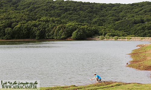
دریاچه سوها
Suha dewatering small lake located within 35 kilometers from Ardabil Ardabil to achieve it should Bigelow to the water and then, after the village of Suha went Nyarq. Less than 5 km at the end of the village to the lake beyond conventional dirt to be easily crossed by car. این دریاچه زیبا درست جایی واقع شده است که جنگلهای زیبای گیلان شروع می شوند و یک مقصد گردشگری رویایی برای همه ی طبیعت دوستان است.
مناظر پایین تر از دریاچه سوها
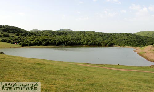
دریاچه سوها زیبا و آرام
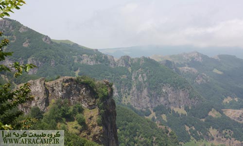
ارتفاعات مرز بین دو استان
شیب منفی
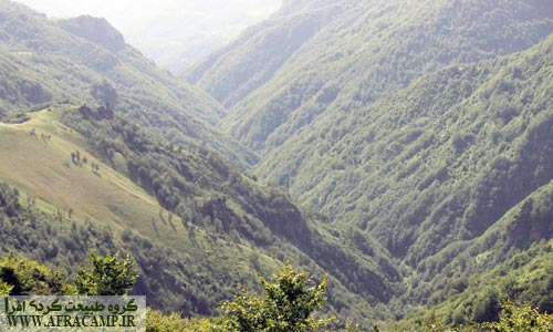
دره های مملو از درخت

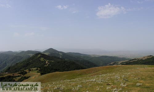
مسیر سوها به لاتون بسیار سرسبز است و گاهی از مرتع و گاهی جنگل پذیرای شماست.
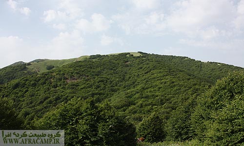
جنگل متراکم
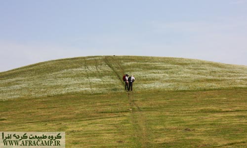
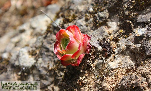
تپه پر از گل

پس زمینه ویندوز
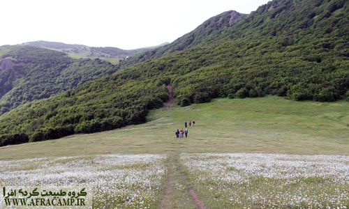
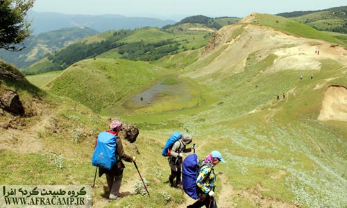
از دریاچه سوها ابتدا از این جنگل و مسیر عبور خواهید کرد.

باید رفت…
پیمایش بین دریاچه سوها و آبشار لاتون یکی از زیباترین برنامه هایی بود که اجرا کرده ایم، لحظه به لحظه این سفر یک روزه سرشار از دیدنی های بکر و مهیج بود.
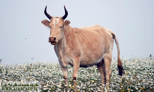
گل گاو و زبان قاصر من…

No Description
در ادامه مسیر از کنار قله اسپیناس عبور خواهید کرد که یک دکل مخابراتی بر روی آن نصب است و می بایست در اینجا جاده خاکی را ترک و وارد پاکوب به سمت پشت کوه شد.

زیر پای اسپیناس

پس از گذر از کنار اسپیناس منظره ای فوق العاده زیبا و دالان مانند جنگلی پیش روست.
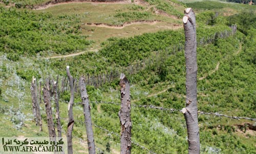
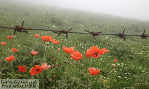
پر چین با سیم خاردار
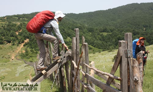
عبور از پرچین به سمت آبشار

توت فرنگی جنگلی
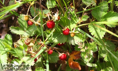
این توت فرنگی ها بعد از عبور از پرچین فراوان یافت می شد
No Description

No Description
پاییز سال قبل از سمت لوندویل به دیدار آبشار پرآب و پر سروصدای لاتون رفته بودیم که مه شدید نگذاشت چیزی از ابهت ارتفاع آبشار ببینیم همین دیدار ناقص انگیزه ای شد برای اجرای این برنامه در بهار و امسال از سمت سوها و اردبیل مسیر شانزده کیلومتری را طی We, the news this season is roaring cascade of water…
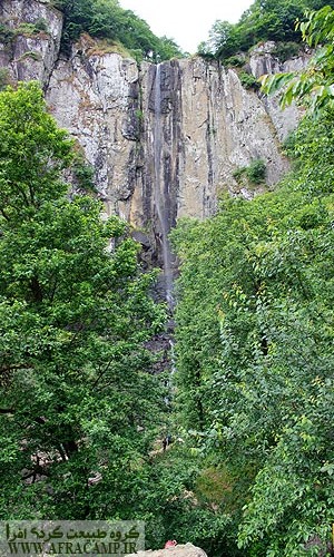
Latoon Waterfall

دیواره آبشار محلی است برای کارگاه زدن و دست به طناب شدن
No Description
از عمویدالله و کلبه اش در نزدیکی آبشار که این روزها سرش نسبتا شلوغ است خداحافظی می کنیم و رهسپار کوته کومه می شویم، جایی که آبگرم طبیعی آن انتظار مارا می کشد.
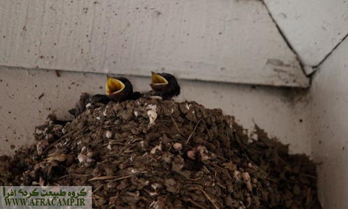
چلچله ها که میهمان بهاره نیمه شمالی کشور هستند، از هر جای مسقفی برای لانه سازی و زاد آوری استفاده می کنند
پایان
از دریاچه سوها تا آبشار لاتون ۱۶ کیلومتر مسیر با تغییر ارتفاعی در حدود ۱۰۰۰ متر پیش روست که در این مسیرتنها یک چشمه در مسیر بود که قابل شرب نبود. پس می بایست آب لازم را حمل نمود. در نزدیکی آبشار و کلبه عمو یدالله چشمه وجود دارد و امکان اقامت در کلبه نیز هست. از آبشار لاتون تا کوته کومه که جاده ای جنگلی است مسافتی ۹ کیلومتری در انتظار است.
پیمایش مسیر سوها به لاتون به طور متوسط ۸ ساعت به طول می انجامد و برای ادامه مسیر تا کوته کومه به زمان ۳ ساعته احتیاج دارید. با توجه به شیب مسیر و سرعت پیمایش می توان در صورت آمادگی گروه، مسیر را با کوله پشتی یک روزه به آسودگی طی نمود.
در برخی نقاط مسیر سوها به لاتون پاکوب محو و غیر قابل تشخیص است که به سبب وجود این موارد داشتن GPS یا راهنما ضروری حس می شود.
برای آشنایی با مسیر پیمایش سوها به لاتون و نشانه گذاری ها، فایل GPS در Donate Placed. Rick Latvn narrow path to the village in a separate report detailing the given path.
Related Content:
Latoon Waterfall(Lavandevil, Gilan )

I love to travel before any strange feeling and enthusiasm, and to explore the depths of my ignorance
Iran is full of neglect that are worth seeing…


Really great
After a full navigation route, spa village's narrow Rick really tired of people not in.
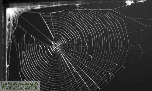
Ks·hatvn the super-berries… Swallows and cobweb
You'll also held public trips?
Peace be upon you for your attention Vspas. In connection with Svaltvn I have that are currently not.
Great Vzybast ???☝
Thank you, John H.
Hi, thanks for sharing that's nice trip… Along the way security is necessary for a family of three (Parents and a nine year old boy ) S?
Hello and thank you
Suha path to Lawton own unique charm along with good security Brkhvrdarh just have to have good physical fitness too.
Peace be upon you
Descriptions and images for recognition of excellent hiking trails . ممنون از شما .
Hello and thank Ltftvn. Pleased to useful content located
Hey, we're going to Tehran path, we go by car. Where the engines we let him in your opinion? Where to go?
We're walking Mykhaym from Suha to Lawton.
For example, the engines Rick's car Tunja we let him go short, we go from Kota Rick Nissan Suha Suha and walk back?
Or go by car Ardebil, Ardebil up the engines and we let him … ?
please guide me
Peace be upon you, your suggestion is that if you insist go by car, first let me go there and Ardebil Ardabil car with a charter to Suha sure way. From beyond the narrow Rick Lawton and that you walk. Rick is easily the charter will go from Kota Astara and from Astara to Ardabil, who is linear.
Good luck
Very helpful and excellent
Thank you ?
Hello and thank you for your encouragement
Hello and thank you for what you did.
We're going from the Wiki and a private car to go, I will be grateful to answer me the question.
1- Is there adequate security along the lake that Mashynarv one or two days there and ourselves we let him go into the waterfall?
2- How much is the approximate temperature of the air at the lake in early July? (In terms of camping by the lake and take advantage of the lake for swimming). Is not very cold lake water to swim?
3- The possibility of putting boats in the lake there? (We inflatable boat used on Lake Gohar)
4- Lake-Lawton routing capabilities to camp overnight in terms of security, shelter, trees, firewood and … how's it?
5- Between the village and the lake (For someone who had a good body condition) How much?
Peace be upon you, I'm sorry that overall answers: There are security problems, but if you want to be comfortable Khyaltvn Suha village car park. In case the weather is warm and the sun during the day but at night Khnkh. There are no facilities along the way to Lawton route. There are many places water is not available, but camping facilities. In the spring there Lawton. The village of Suha to the lake a little over an hour's walk in the craft of 5 Kylvmtrh.
Hello friends . Very beautiful Sfrtvn . And much used Rahnmayyhatvn . Wow good luck .
Peace be upon you, glad helpful
Hello and thanks… Excellent and beautiful
We hope to promote a culture of life in nature is more work to be done
Peace be upon you, thank Ltftvn
Hi Bsyarmmnvn of information Mfydshma…We come with a choice of bus ..chndsval
1. Where Azatvbvs Jdashym Vatvbvs after the end of the program where Marvsvarknh
٢- Chndkylvmtrh and Chndkylvmtrsh Jnglh entire route?….Ahead of you Tshkrmyknm…Amir
Hey, you're a lake separated from the car and the car in the village to join're a short stack. See the text descriptions associated with distance
Hi Everyone wants tips for passenger car Nissan will contact you'm grateful 09143583789
Thank you for the way you live a full explanation beyond the blue Nyarq Bigelow Wiki
Peace be upon you
Hello, this is the route and we went, it is much more than 16 km
Hello, the information entered is based on an almost accurate GPS calculation, and related files have been uploaded to Wikiloc..
It was great to greet you
Thanks to Ltftvn